
")
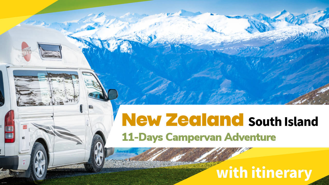
Experience the Top Things To Do on New Zealand’s South Island in this blog covering our 11-Day New Zealand South Island Itinerary. From lakes and mountains to glaciers and fjords, we explored the top highlights and hidden gems of the South Island — all at our own pace in a campervan. Whether you’re planning your next New Zealand trip or just dreaming about it, this blog includes our full 11-day self-drive itinerary to help you make it happen. Don’t miss this 11-Day New Zealand South Island Itinerary!
Date visited: Nov-2024
Advertisements
")
New Zealand South Island Self-Drive Campervan Trip
In this blog, you’ll find a detailed day-by-day breakdown of our unforgettable road trip across New Zealand’s South Island — including must-see sights, scenic drives, recommended stops, and where we stayed each night in our campervan.
We traveled in November, which gave us a mix of spring blooms and snow-capped mountains — perfect for photos and outdoor adventures. This itinerary is ideal for first-timers, nature lovers, and anyone planning a flexible self-drive journey at their own pace.
South Island: The Ideal Destination for First-Timers
For first-time visitors to New Zealand, the South Island is the ultimate destination — and the best place to start your adventure. With its stunning natural beauty, the South Island offers more dramatic mountain ranges, crystal-clear lakes, and iconic landscapes than the North Island.
If you’re planning a 2-week New Zealand South Island itinerary, focusing solely on the South Island lets you experience the country’s top scenic highlights without the added cost or time of traveling between islands. Instead of rushing, you can explore at a more relaxed pace, diving deeper into each destination and making the most of your New Zealand road trip.
")
Book Your Stays in Advance
If you’re planning a campervan road trip around New Zealand, it’s highly recommended to book your accommodation and campsites in advance — especially during the peak travel season from November to March.
Popular spots like Lake Tekapo, Mount Cook, Queenstown, and Te Anau often fill up quickly, and powered campervan sites are limited. Booking early ensures you secure your preferred stays and travel with peace of mind, rather than scrambling for availability at the last minute.

Advertisements
New Zealand South Island Itinerary (11-Day Road Trip)
Day 1: Arrival in Christchurch
Day 1: Arrival in Christchurch – Drive to Lake Tekapo
Your New Zealand South Island adventure begins! After landing in Christchurch, pick up your campervan, stock up on groceries, and hit the road for a scenic drive to the iconic Lake Tekapo.
Stay: Lake Tekapo (Lakes Edge Holiday Park)
Advertisements
Day 2: Lake Tekapo & Surroundings
Start your day by exploring the stunning turquoise waters of Lake Tekapo and its charming lakeside sights. After soaking in the beauty, make the scenic drive towards Mount Cook and stay near the national park — ready for an unforgettable day of alpine adventure tomorrow.
2.1: Lake Tekapo (Map)
This glacial lake is famous for its bright blue color, caused by finely ground rock particles suspended in the water. The lake is surrounded by snow-capped mountains, making it one of the most photogenic spots in New Zealand.
")
2.2: The Church of the Good Shepherd (Map)
This charming stone chapel sits right by the lake, perfectly framed by the Southern Alps. It’s one of the most photographed church in New Zealand and a peaceful place to pause and take in the view.
")
2.3: Mt John Observatory (Map)
Perched atop Mount John, the observatory offers panoramic views over Lake Tekapo and the Mackenzie Basin. It’s also part of a Dark Sky Reserve, ideal for stargazing at night.
It is possible to drive up to Mt John Observatory during the day, but a small road user fee is required per vehicle.
")
2.4: Lake Pukaki Viewpoint (Map)
Just a short drive away, this viewpoint offers incredible views of Lake Pukaki with Mount Cook looming majestically in the distance. On a clear day, the water’s mirror-like surface creates a dramatic reflection.
")
2.5: Tapataia Mahaka Peter’s Lookout (Map)
One of the most iconic lookouts on the drive to Mount Cook, offering sweeping views of Lake Pukaki and the snow-dusted peaks of Aoraki/Mount Cook National Park.
Stay: Glentanner (Glentanner Park Centre)
")
Advertisements
Day 3: Mount Cook & Tasman Glacier
Spend the first half of the day immersed in the alpine beauty of Aoraki/Mount Cook National Park — hiking iconic trails and admiring glaciers. By early afternoon, begin the long but scenic drive south to Te Anau, where you’ll stay the night in preparation for the epic journey to Milford Sound the next day.
3.1: Hooker Valley Track (Map)
This relatively easy 3-hour return hike offers postcard-worthy views of Mount Cook. Swing bridges, alpine streams, and glacier-fed lakes make this one of New Zealand’s most iconic walks.

3.2: Mueller Lake Lookout and First Swing Bridge (Map)
Located along the Hooker Valley Track, this spot gives you a great vantage point of Mueller Glacier Lake. The first swing bridge adds a little adventure and stunning photo opportunities.
If you’re short on time to complete the Hooker Valley Track, consider turning back at the First Swing Bridge. The lookout and swing bridge is approximately 15 minutes walk from the carpark.

3.3: Tasman Glacier View (Map)
This short but steep trail rewards you with sweeping views of Tasman Glacier — New Zealand’s longest glacier — and its iceberg-dotted terminal lake. The walk involves climbing around 300 steps and takes about 15 to 20 minutes one way. The breathtaking alpine panorama at the top makes the effort absolutely worthwhile.

3.4: Lindis Pass Viewpoint (Map)
This high-altitude mountain pass offers striking views of tussock-covered hills. It’s especially stunning in the golden light of late afternoon.
Stay: Te Anau (the last major town before Milford Sound)
Advertisements
Day 4: Milford Sound
Today, embark on one of the most breathtaking drives in New Zealand as you journey from Te Anau to Milford Sound through the heart of Fiordland National Park. The route is dotted with majestic viewpoints and short scenic stops, so be sure to leave early to enjoy them at a relaxed pace.
Once at Milford Sound, the best and easiest way to explore its stunning fjords and towering cliffs is on a 2-hour scenic cruise. Afterward, keep track of the Homer Tunnel’s closing hours before retracing your way back to Te Anau for the night.
4.1: Eglinton Flats (Map)
Located in Fiordland National Park along the Milford Road, Eglinton Flats is a broad, open valley surrounded by steep, forested mountains. The area was one of the first glacial valleys in the park accessible by road. It’s known for its flat grassy plains, low morning mist, and reflective puddles — a popular stop for photographers and tour buses.

4.2: Christie Falls (Map)
Christie Falls is a roadside waterfall along the Milford Road, cascading down a rocky cliff face. Fed by alpine streams from the surrounding peaks, it’s especially striking after heavy rain. Although not signposted, it’s easily visible from the road and worth a brief stop.

4.3: Monkey Creek (Map)
Monkey Creek is a glacial spring located along Milford Road, surrounded by steep alpine peaks. The water here is crystal-clear and safe to drink, fed directly from the surrounding snowmelt. It’s a popular stop for photos, thanks to the dramatic backdrop of sheer mountains and often snow-dusted terrain.
It’s also a well-known spot to see kea, New Zealand’s native alpine parrot. These intelligent and cheeky birds are often seen around parked cars — admire them from a distance, but don’t feed them.

4.4: Homer Tunnel (Map)
Homer Tunnel is a 1.2 km-long, one-lane tunnel carved through solid granite, connecting Milford Sound to the rest of the South Island via the Milford Road. It operates in one direction at a time, so drivers must follow traffic signals and wait their turn. The tunnel has daily closing hours, after which no vehicles are allowed to enter or exit Milford Sound, making time management essential for all visitors.

4.5: Milford Sound (Cruise) (Map)
Milford Sound is a deep fiord surrounded by towering cliffs and peaks, including the iconic Mitre Peak which rises 1,692 meters straight from the water. The best and most accessible way to experience Milford Sound is by joining a 1.5 to 2-hour boat cruise, which takes you past dramatic waterfalls, sheer rock faces, and, with luck, sightings of seals, dolphins, or even penguins. Cruises depart from the main terminal and run throughout the day, offering close-up views of the fiord’s natural features from sea level.
")
4.6: Pop’s View Lookout (Map)
Pop’s View Lookout is a roadside stop along Milford Road offering a high vantage point over the Hollyford Valley. The viewpoint provides a wide-angle perspective of dense native forest, steep valley walls, and distant alpine peaks. It is named for Robert Alister Andrew, who died in an avalanche in 1983.
Stay Te Anau

Advertisements
Day 5: Queenstown–Glenorchy Scenic Drive
Depart from Te Anau and head toward Queenstown, widely regarded as the adventure capital of New Zealand. After reaching Queenstown, continue north along the Queenstown–Glenorchy Scenic Drive — a 45 km lakeside road that follows the winding edge of Lake Wakatipu.
This route is considered one of the most scenic drives in the country due to its combination of alpine mountains, glacial valleys, and uninterrupted lake views. The drive is especially popular for its numerous lookout points and its cinematic landscapes, many of which were featured in The Lord of the Rings films.
5.1: Devil’s Staircase Lookout Point (Map)
This lookout sits along the winding section of State Highway 6 known as the Devil’s Staircase. The viewpoint offers elevated views over the southeastern arm of Lake Wakatipu, with the Eyre Mountains visible across the lake. The name comes from the steep, serpentine nature of the highway in this section.
5.2: Queenstown to Glenorchy Scenic Drive
This stretch of road follows the shoreline of Lake Wakatipu and cuts through steep terrain shaped by glacial activity. The road provides continuous visibility of the Humboldt and Richardson mountain ranges, with several lay-bys for photography and observation.
5.3: Isengard Lookout (Map)
A filming location from The Lord of the Rings, this flat river valley with a mountainous backdrop was used for scenes set in Isengard. The area offers wide open views of the Dart River and surrounding peaks, making it a must-stop for Tolkien fans and nature lovers alike.
")
5.4: Glenorchy Wharf (Map)
The Glenorchy Wharf lies at the head of Lake Wakatipu where the Dart and Rees Rivers enter the lake. The wharf area includes historical infrastructure and clear views of Mount Earnslaw and the Forbes Mountains to the northwest. The lake here is deep and glacially carved.

5.5: Twenty Five Mile Stream (Map)
This quiet, lesser-known stop features a calm stream flowing into Lake Wakatipu with picturesque reflections of the surrounding hills. It’s a peaceful spot to pause, especially if you’re looking for fewer crowds and natural beauty.

5.6: Bennett’s Bluff Viewpoint (Map)
Easily the most dramatic lookout on the route, Bennett’s Bluff offers a sweeping view over Lake Wakatipu and the road snaking along its edge. This elevated spot is ideal for capturing the rugged grandeur of the landscape, especially during golden hour.
Stay Queenstown

Advertisements
Day 6: KJet Jet Boat, The Remarkables & Fergburger
Start the day with a high-speed jet boat experience with KJet, the first commercial jet boat operator in Queenstown, established in 1958. After the ride, take the steep and winding drive up to the Remarkables Ski Area. The access road offers expansive panoramic views of Lake Wakatipu, Queenstown, and the surrounding ranges — not Kingston, which is located farther south. Although the ski area is closed outside of winter, visitors can freely explore the open space and enjoy the alpine landscape. Return to central Queenstown for dinner and try Fergburger, a famous burger joint widely regarded as serving some of the best burgers in New Zealand.
6.1: KJet Jet Boat (Queenstown) (Map)
KJet operates high-speed jet boat rides from the Queenstown Pier, taking passengers across Lake Wakatipu and into the Kawarau and Shotover Rivers. The ride covers nearly 43 km of waterways and offers views of Queenstown’s surrounding mountains including The Remarkables and Cecil Peak. Established in 1958, KJet is the oldest commercial jet boat company in New Zealand and uses twin-engine boats capable of reaching speeds up to 85 km/h, with sharp spins and fast manoeuvres in shallow braided rivers.
 (New Zealand South Island Itinerary)")
6.2: The Remarkables (Map)
The Remarkables mountain range rises dramatically on the southeastern shore of Lake Wakatipu and is one of only a few mountain ranges in the world that runs directly north to south.
The road up to The Remarkables Ski Area reaches an altitude of around 1,600 metres and offers expansive views over Queenstown, Lake Wakatipu, and the surrounding peaks. The access road is only partially sealed — the upper section near the ski area becomes a gravel road, which is wide but winding. A toll fee is required per vehicle to use the road, which is open to the public even outside the ski season, allowing access to scenic viewpoints and alpine walking tracks.

6.3: Fergburger (Map)
Fergburger is a legendary burger joint located in central Queenstown, renowned across New Zealand and globally for its massive, gourmet-style burgers made with fresh, locally sourced ingredients. Established in 2001, it has become a Queenstown institution, often drawing long queues of both tourists and locals throughout the day. Located just a short walk from the Queenstown lakefront and pier, it’s easily accessible and often regarded as a must-try food stop for visitors exploring the region.
Stay Queenstown

Advertisements
Day 7: Shotover River & Crown Range Road
Head towards Wanaka today. Before leaving Queenstown, stop by the Shotover River to admire its deep gorges and catch a glimpse of the iconic Shotover Jet in action. Then take the famously scenic Crown Range Road — known for being New Zealand’s highest main road — as you climb through dramatic alpine landscapes en route to Wanaka.
7.1: Shotover River (Map)
The Shotover River winds through steep, rugged canyons just outside Queenstown and is a well-known site for adventure tourism. Historically linked to the gold rush, it’s now famous for jet boating and its striking turquoise waters carving through the rocky gorge.
")
7.2: Arrow Junction Lookout Point (Map)
This small roadside viewpoint offers sweeping views over the Arrow Basin, with the Remarkables mountain range visible in the distance. It’s a quick stop with a broad vantage point perfect for a photo break before ascending the Crown Range Road.
7.3: Crown Range Road Scenic Lookout & Summit Marker (Map)
Near the highest point of the Crown Range Road (at 1,076 m), this scenic lookout offers panoramic views across the Queenstown Basin and back toward the mountains. The summit marker is a popular photo stop and gives a clear sense of the road’s elevation and terrain.

7.4: Crown Range Road
Crown Range Road is the highest sealed main road in New Zealand and connects Queenstown to Wanaka via a winding alpine pass. The road features sharp switchbacks, dramatic drop-offs, and incredible high-country views, especially on a clear day.

7.5: Wanaka Tree (Map)
Located at the edge of Lake Wanaka, the lone willow tree famously growing out of the water is one of New Zealand’s most photographed natural icons. Framed by the Southern Alps, it’s especially popular at sunrise or sunset when the light hits the lake and mountains just right.
Stay Wanaka

New Zealand Day 7: Wanaka Tree, Crown Range Road & Shotover River
Advertisements
Day 8: Wanaka to Haast Pass
Start the day by revisiting the picturesque Lake Wanaka and its iconic tree before beginning the scenic drive westward via the Haast Pass — a mountain pass known for its waterfalls, dense forests, and dramatic river gorges. Along the way, stop at several lookouts including Lake Hawea and the turbulent Gates of Haast. End the day at the rugged West Coast with a peaceful visit to Ship Creek.
8.1: Wanaka Tree
(See section 7.5)
8.2: Lake Hawea Lookout (Map)
Perched above the shores of Lake Hawea, this roadside lookout offers panoramic views of the deep blue lake backed by sharp, glacially-carved mountain ridges. It’s a quick but breathtaking stop just before crossing into Haast Pass.
")
8.3: Lake Wanaka Lookout (Map)
This scenic point provides sweeping views over Lake Wanaka’s glistening waters and its surrounding peaks. It offers a great contrast to the earlier lakeside views in Wanaka town, highlighting the vast scale of the Southern Lakes region.
8.4: Gates of Haast (Map)
This dramatic section of the Haast River cuts through a narrow rocky gorge, with powerful waters surging beneath the highway bridge. It’s a key highlight of Haast Pass, showcasing the raw energy of glacial rivers carving through the Southern Alps.

8.5: Ship Creek (Map)
Located near the coast, Ship Creek features short walking tracks through dune lakes and swamp forests. It’s a great introduction to the West Coast’s rugged, untouched landscape — where lush rainforests meet wild beaches — and ideal for stretching your legs after the long drive.
Stay Haast

Advertisements
Day 9: Fox Glacier and Franz Josef Glacier
Depart from Haast and head north along the West Coast towards Glacier Country. The journey offers a mix of dramatic coastal scenery and lush rainforest as you pass scenic stops like Knights Point and Bruce Bay. Highlights of the day include short walks to view New Zealand’s iconic glaciers and a tranquil lake known for its perfect mountain reflections. End the day in the town of Hokitika.
9.1: Knights Point Lookout (Map)
This coastal lookout offers sweeping views over the rugged Tasman Sea and dramatic cliffs plunging into the ocean. It marks the point where the highway leaves the coast and heads inland toward the Southern Alps.
")
9.2: Bruce Bay View Point (Map)
Bruce Bay is a wild stretch of coastline lined with driftwood and flanked by dense forest. A scenic and often windy stop, it’s a great place to experience the raw power of the West Coast’s environment.

9.3: Fox Glacier South Side Walk (2 hr return) (Map)
This well-maintained track takes you through lush rainforest and along the banks of the Fox River to a viewpoint of Fox Glacier’s terminal face. It’s one of the best ways to see the glacier without a helicopter and takes about 2 hours return on mostly gentle terrain.
")
9.4: Lake Matheson Walk, Jetty Viewpoint (Map)
Known for its mirror-like reflections of Aoraki / Mt Cook and Mt Tasman on a calm day, the walk to the Jetty Viewpoint is a highlight. The full loop takes around 1.5 hours, but it’s a short 40-minute return walk to reach the iconic photo spot.

9.5: Franz Josef Glacier Walk (30 min return)
This easy gravel track leads to a viewpoint overlooking the terminal face of Franz Josef Glacier. While weather prevented us from doing this walk, it typically takes about 30 minutes return and provides a close-up view of one of New Zealand’s most famous glaciers.
Stay Hokitika
Advertisements
Day 10: Arthur’s Pass
Today marks the transition from the West Coast back to the East Coast via the iconic Arthur’s Pass. This historic alpine route is the highest of the three major passes crossing the Southern Alps and is known for its dramatic terrain, sweeping mountain views, and feats of engineering like the Otira Viaduct. First opened in 1923, it remains one of New Zealand’s most scenic and essential highways, connecting Hokitika and Christchurch.
10.1: Otira Viaduct Lookout (Map)
This viewing point overlooks the impressive Otira Viaduct — a 440-meter-long bridge spanning a steep and geologically unstable section of the pass. Built in 1999, the viaduct is a key engineering solution to prevent rockfalls and landslides, offering a safe and scenic route through the most rugged part of the drive.
")
10.2: Arthur’s Pass Village (Map)
Situated at the heart of the pass, this small alpine village serves as the main base for exploring Arthur’s Pass National Park. It offers basic services, hiking information, and often sightings of the native kea — a cheeky alpine parrot known to frequent the area.
10.3: Arthur’s Pass National Park Visitor Centre (Map)
The visitor centre provides detailed information on local walks, wildlife, and geology. It’s an ideal place to get oriented before exploring the surrounding landscape and learn about the region’s rich natural and human history.
10.4: Arthur’s Pass Scenic Lookout (Map)
Located just outside the village, this viewpoint provides sweeping views of the alpine valley and surrounding peaks. It’s a great photo stop to take in the scale and drama of the Southern Alps.

10.5: Waimakariri River Lookout (Map)
This lookout offers panoramic views of the braided Waimakariri River as it winds through a wide valley carved by glacial activity. The contrasting textures of river, rock, and forest make it a striking stop.

10.6: Lake Pearson (Map)
Nestled in a broad valley, Lake Pearson is a tranquil, mirror-like lake popular with birdwatchers and campers. It’s a peaceful spot to stretch your legs and enjoy the surrounding alpine setting.
10.7: Castle Hill (Map)
Famed for its massive limestone boulders scattered across rolling hill country, Castle Hill has spiritual significance for Māori and is a favorite spot for climbers and photographers. The short walk from the carpark leads to a surreal landscape often referred to as a natural “rock garden.”
Stay Christchurch

Advertisements
Day 11 (Final Day): Hanmer Springs
After nearly two weeks on the road, Day 11 is the perfect time to slow down and recharge before wrapping up your South Island adventure. Head to the charming alpine village of Hanmer Springs, known for its relaxed pace and fresh mountain air. Spend your final afternoon soaking at the Hanmer Springs Thermal Pools & Spa, where you can ease tired muscles in natural hot pools, breathe in the crisp alpine atmosphere, and reflect on the incredible journey you’ve just completed.
11.1: Hanmer Springs Thermal Pools & Spa (Map)
Set against a backdrop of snow-capped peaks and pine forests, Hanmer Springs Thermal Pools & Spa is one of New Zealand’s most iconic wellness destinations. It offers a unique mix of natural relaxation and family-friendly fun, with something for every type of traveler.
The complex features:
- Natural Thermal Pools – Geothermally heated and mineral-rich, ideal for soothing body and mind.
- Sulphur Pools – Slightly hotter and milky in appearance, known for their therapeutic benefits.
- Aqua Therapy Pools – Equipped with water jets to relieve muscle tension and boost circulation.
- Water Slides & Kids’ Areas – A hit with families and anyone looking for a splash of excitement.
- Private Pools & Day Spa – For a more indulgent experience, book a private soak or a relaxing massage.
- Whether you’re looking to relax, rejuvenate, or simply soak in the mountain views, Hanmer Springs is the perfect final stop on your South Island itinerary.
(End of Trip)
")
Advertisements
")
End of Trip – Wrapping Up Your South Island Adventure
After 11 unforgettable days exploring the best of New Zealand’s South Island — from glaciers and fjords to alpine roads and natural hot springs — you’ll leave with a camera full of stunning views and a heart full of memories. This flexible self-drive campervan itinerary allows you to experience the highlights at your own pace, while still uncovering hidden gems along the way.
Whether you’re planning your own adventure or just dreaming of one, we hope this itinerary helps you map out an epic South Island road trip you’ll never forget.
Tip: If you’re flying out of Christchurch the next morning, consider staying the night near the airport for convenience — especially if you have an early flight.
Advertisements
Our full list of New Zealand blogs:
- Lake Tekapo – New Zealand Campervan Adventure Day 2
- Mount Cook & Tasman Glacier – New Zealand Day 3
- Milford Sound – New Zealand Campervan Adventure Day 4
- Queenstown-Glenorchy Scenic Drive – New Zealand Day 5
- Jet Boat in Queenstown (KJet) – New Zealand Day 6
- The Remarkables and Fergburger – New Zealand Day 6
- New Zealand Day 7: Wanaka Tree, Crown Range Road & Shotover River
- Wanaka to West Coast – New Zealand Day 8
- Arthur’s Pass – New Zealand Campervan Adventure Day 10
- Hanmer Springs Thermal Pools – New Zealand Day 11
Advertisements
Leave a Reply