
")
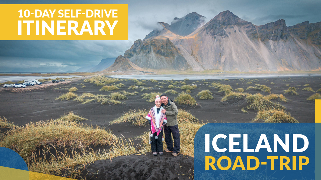
This Iceland 10-Day Road Trip Itinerary is designed for travelers who want a clear, practical plan for exploring Iceland by self-drive. This was our second time doing a round-island road trip — the first was back in June 2014 on a two-week journey. In June 2025, we returned to revisit what we consider Iceland’s best highlights, while adding several locations we missed the first time, creating a well-balanced itinerary that combines classic sights with new discoveries.
Date visited: Nov-2024
Advertisements
Planning an Iceland Road Trip: Overview & Tips
Iceland is one of the easiest countries in the world for a self-drive road trip. The entire island is connected by Route 1, commonly known as the Ring Road, which is approximately 1332km long and circles the country, linking most major towns including Reykjavík. More importantly, many of Iceland’s most famous attractions — waterfalls, glaciers, volcanic areas, and coastal viewpoints — are located directly along or just off this road. By planning your itinerary around the Ring Road, you can efficiently cover the majority of Iceland’s highlights without complex navigation or backtracking.
For those visiting in summer, a self-drive itinerary also allows access to Iceland’s interior highlands via designated F-roads, which are only open for a limited period each year and require a 4×4 vehicle. While the Ring Road itself is fully paved and suitable for standard cars, F-roads are gravel tracks that may involve river crossings and rapidly changing conditions.
Key tips for an Iceland road trip:
- Plan at least 10–14 days for a full round-island drive to avoid rushing.
- Summer (June–August) offers long daylight hours and access to highland roads.
- F-roads are only open seasonally and require a 4×4 vehicle; always check road conditions before driving.
- Some F-roads are challenging even for experienced drivers — research carefully and seek local advice if unsure.
- Accommodation outside Reykjavík is limited and expensive; book well in advance, especially in peak season.
- Grocery stops early in the trip help reduce food costs in remote areas.
")
Advertisements
Day-by-Day Iceland Itinerary (10-Day)
Iceland Itinerary Day 1: Arrival in Iceland
The first day was focused on arrival logistics and settling in after the international flight. Picking up the rental car and stocking up on supplies set the foundation for the road trip ahead. Staying near the airport allowed us to rest and start fresh the next morning.
1.1: Arrive at Keflavík International Airport (KEF)
We touched down at Iceland’s main international airport and picked up our rental car from Blue Car Rental — efficient and essential for exploring Iceland independently.
1.2: Supermarket Stop in Keflavík
Before heading out, we stocked up on groceries and snacks. With Iceland’s remote landscapes and limited dining options outside towns, advance preparation is important.
1.3: Overnight Stay in Keflavík
After a long flight, we stayed overnight in Keflavík to rest and prepare for the journey inland the next day.
Advertisements
Iceland Itinerary Day 2: The Golden Circle Tour Begins
Day 2 introduced us to Iceland’s geology and history through the classic Golden Circle route. Located close to Reykjavík, this loop offers a high concentration of iconic sites in a short driving distance, making it an ideal start to the trip.
2.1: Þingvellir National Park (Thingvellir National Park)
This UNESCO World Heritage Site lies in a rift valley where the North American and Eurasian tectonic plates meet. It is also the site of Iceland’s first parliament, founded over 1000 years ago.
")
")

2.2: Geysir Geothermal Area (The Geyser Area)
This geothermal field features boiling mud pools and steaming vents, with Strokkur erupting every 5–10 minutes. Water shoots up to 20m into the air during each eruption.
2.3: Gullfoss Waterfall (Golden Falls)
A powerful two-tiered waterfall that plunges into a deep canyon. Gullfoss is one of Iceland’s most famous waterfalls and a highlight of the Golden Circle.
 (Iceland Itinerary 10-Day Road Trip)")

Advertisements
Iceland Itinerary Day 3: F208 Highland Road Adventure + Landmannalaugar
This day was dedicated to driving one of Iceland’s highland routes, offering landscapes very different from the coastal Ring Road. Although weather conditions limited access to Landmannalaugar itself, the journey along F208 was a highlight in its own right.
3.1: F208 Road to Landmannalaugar (Map)
A rugged highland gravel road cutting through lava fields and moss-covered valleys. The scenery here represents Iceland’s volcanic interior at its most raw.
")
3.2: Sigoldufoss Waterfall (Map)
A lesser-known waterfall surrounded by volcanic rock formations. Its quiet setting makes it a rewarding stop along the route.

3.3: Old River Crossing (Bjallavað)
A historic crossing point on the F208 where we stopped for photos and drone footage.
3.4: Hnausapollur (Bláhylur) Viewpoint (Map)
A volcanic crater lake known for its intense blue color. The contrast between the water and surrounding terrain makes it especially photogenic.
 Viewpoint (Iceland Itinerary 10-Day Road Trip)")
3.5: Frostastaðavatn Scenic Viewpoint (Map)
A viewpoint overlooking a volcanic lake framed by lava fields and rhyolite mountains, showcasing Iceland’s diverse geology.
")
3.6: Landmannalaugar
Landmannalaugar is one of Iceland’s most famous highland destinations, known for its vividly colored rhyolite mountains, geothermal hot springs, and extensive hiking trails. The area is a major starting point for multi-day hikes such as the Laugavegur Trail and is considered a highlight of Iceland’s volcanic interior.
Due to heavy rain, we skipped the final river crossing leading into Landmannalaugar and had to miss out on exploring this nature wonderland.
Advertisements
Iceland Itinerary Day 4: South Coast Waterfall Chasing – 5 Must-See Falls
Day 4 focused on Iceland’s South Coast, home to some of the country’s most accessible and impressive waterfalls. Despite rain and mist, the conditions added atmosphere to each stop.
4.1: Seljalandsfoss
A 60m high waterfall where visitors can walk behind the cascading water. Expect to get wet from the spray.
")


4.2: Gljúfrabúi (Gljufrabui) (Map)
A hidden waterfall located inside a narrow gorge near Seljalandsfoss. Reaching it requires a short walk through shallow water.


4.3: Skógafoss
Skógafoss is one of Iceland’s largest and most iconic waterfalls, standing about 60m high and 25m wide. Its immense water flow creates heavy mist, often producing vivid rainbows on sunny days.
")

4.4: Kvernufoss (Map)
A quieter waterfall accessed via a short walk near the Skógar Museum (short drive from Skógafoss). It offers a similar walk-behind experience without crowds.

4.5: Urriðafoss (Urridafoss) (Map)
A wide, high-volume waterfall located near Route 1. While not tall, it is known for its sheer power. The name means “Trout Falls,” reflecting the river’s historical importance as a fishing area.
Advertisements
Iceland Itinerary Day 5: Volcanic Colors & Coastal Cliffs – Kerið + Dyrhólaey
This shorter day focused on two contrasting landscapes: a colorful volcanic crater and dramatic coastal cliffs. Both stops required minimal hiking but delivered strong visual impact.
5.1: Kerið (Kerid)
A volcanic crater with a vivid blue lake surrounded by red and green slopes. A walking path circles the rim, and a small entrance fee applies.
")

5.2: Dyrhólaey (Dyrholaey)
A prominent headland on Iceland’s South Coast, offering expansive views of black sand beaches, sea cliffs, and the iconic natural rock arch extending into the Atlantic. The area also features a lighthouse at the highest point, which serves as both a navigation aid and a scenic viewpoint overlooking the coastline. In summer, Dyrhólaey is an important seabird nesting area, including puffins, making it a popular stop for both scenery and wildlife.
")
 (Iceland Itinerary 10-Day Road Trip)")
")
Advertisements
Iceland Itinerary Day 6: Ice, Waves & Peace – Sólheimajökull, Reynisfjara & Vík
Day 6 highlighted the contrasts of Iceland’s south coast, moving from glacial landscapes to powerful ocean scenery and ending in a quiet village viewpoint.
6.1: Sólheimajökull (Solheimajokull)
An outlet glacier from the Mýrdalsjökull ice cap, featuring crevasses and ash-streaked ice. Guided tours are required for glacier walks.
(Iceland Itinerary 10-Day Road Trip)")
")
6.2: Reynisfjara (Reynisfjara Black Sand Beach)
Iceland’s most famous black sand beach, known for its jet-black volcanic sand, hexagonal basalt columns, and dramatic coastal cliffs. Offshore, the Reynisdrangar sea stacks rise from the Atlantic and are tied to Icelandic folklore. The beach is also known for powerful sneaker waves, so visitors must keep a safe distance from the shoreline.
(Iceland Itinerary 10-Day Road Trip)")
. Iceland’s most famous black sand beach.")


6.3: Vík í Mýrdal Church (Vik i Myrdal Church)
A hilltop church overlooking the village of Vík, offering panoramic views of the coastline and offshore sea stacks.

Advertisements
Day 7: Glacier Wonders – Svínafellsjökull, Fjallsárlón, Diamond Beach & Jökulsárlón
This day was spent within Vatnajökull National Park, showcasing Iceland’s most famous glacial landscapes and lagoons.
7.1: Svínafellsjökull (Svinafellsjokull)
An outlet glacier of the Vatnajökull ice cap, with dramatic ice formations and surrounding mountain scenery. Accessible via a short walk from the parking area.
(Iceland Itinerary 10-Day Road Trip)")

7.2: Fjallsárlón (Fjallsarlon Glacier Lagoon)
A quieter glacier lagoon with floating icebergs and fewer visitors compared to Jökulsárlón.
(Iceland Itinerary 10-Day Road Trip)")

7.3: Diamond Beach
A black sand beach scattered with ice chunks washed ashore from nearby lagoons.


7.4: Jökulsárlón (Jokulsarlon Glacier Lagoon)
Jökulsárlón is Iceland’s most famous glacier lagoon, formed where the Breiðamerkurjökull glacier (an outlet of Vatnajökull) meets the Atlantic. Gigantic icebergs calve from the glacier and drift across the lagoon before floating out to sea, creating a constantly changing and photogenic landscape. The lagoon has appeared in numerous films, including James Bond movies, and is located adjacent to the striking black sands of Diamond Beach.
(Iceland Itinerary 10-Day Road Trip)")

Advertisements
Day 8: Black Sands, Coastal Beacons & Hidden Waterfalls – Stokksnes, Hvalnes & Fólaldafoss
Day 8 marked our entry into East Iceland, an area known for wide-open landscapes and fewer crowds.
8.1: Stokksnes (Map)
A black sand area dominated by the dramatic Vestrahorn mountain. The shifting sands and sharp peaks make it a popular photography location.
")

")
8.2: Hvalnes Lighthouse (Map)
A coastal lighthouse offering sweeping ocean views and a sense of isolation along the rugged shoreline.


8.3: Fólaldafoss (Folaldafoss) (Map)
A quiet waterfall located along Road 939, surrounded by remote and rugged terrain.
")
")
Advertisements
Day 9: Basalt Canyons, Volcanic Craters & Legendary Falls – Stuðlagil, Víti & Goðafoss
This day explored the geological highlights of North Iceland, featuring basalt formations, volcanic landscapes, and historic waterfalls.
9.1: Stuðlagil (Studlagil Canyon) (Map)
Stuðlagil Canyon, located in eastern Iceland, is famous for its striking basalt columns and vivid glacial river. Once hidden beneath high water levels, the canyon was revealed in recent years, becoming one of Iceland’s most visually dramatic natural landscapes.
Top Tip: For the best views of Stuðlagil Canyon, park at the main parking lot (map link) and hike approximately 2.4 km to the canyon. This route takes you to the south-east side, where you can also walk down to the water level for an immersive experience.
A new visitor centre and viewing platform (map link) is being built on the north-west side of the canyon. This access requires no hiking but involves descending a set of stairs. Views from this side are limited, and it’s not possible to reach the water level.
(Iceland Itinerary 10-Day Road Trip)")


9.2: Víti Crater (Krafla)
A geothermal explosion crater with a milky blue lake, located within the active Krafla volcanic area.
9.3: Goðafoss (Godafoss Waterfall)
Goðafoss is one of the country’s most famous waterfalls. Formed by the Skjálfandafljót River, it is about 12m wide and 12m high. The name means “Waterfall of the Gods”, originating from a 10th-century legend in which pagan idols were thrown into the falls after Iceland’s conversion to Christianity.
(Iceland Itinerary 10-Day Road Trip)")

Advertisements
Day 10: Snæfellsnes Peninsula Loop – Kirkjufell, Ingjaldshóll, Saxhóll & More
The final day looped around the Snæfellsnes Peninsula, often described as “Iceland in miniature” due to its varied landscapes.
10.1: Snæfellsnesvegur (Road 54)
A scenic coastal road connecting volcanic craters, fishing villages, and coastal cliffs.
 (Iceland Itinerary 10-Day Road Trip)")
10.2: Kirkjufell (Kirkjufell Mountain)
One of Iceland’s most photographed mountains, known for its distinctive shape.
")
10.3: Ingjaldshóll Church (Ingjaldsholl Church) (Map)
A historic church offering cultural contrast to the surrounding volcanic terrain.
 (Iceland Itinerary 10-Day Road Trip)")


10.4: Saxhóll Crater (Saxholl Crater)
An accessible volcanic crater with panoramic views from the rim.
10.5: Arnarstapi
A coastal village known for cliffs, basalt formations, and seabird colonies.

10.6: Búðakirkja Church (Budakirkja Church) (Map)
A black wooden church set against lava fields and open landscapes.
")

10.7: Gerðuberg Cliffs (Gerduberg) (Map)
A striking wall of hexagonal basalt columns formed by ancient lava flows.
")

Advertisements
(Iceland Itinerary 10-Day Road Trip)")
Final Thoughts
This Iceland 10-Day Road Trip Itinerary offers a practical and efficient way to experience the country’s diverse landscapes — from highlands and glaciers to waterfalls, volcanoes, and coastal cliffs.
By following the Ring Road and selectively adding detours, it’s possible to see Iceland’s most iconic sights without rushing. Whether it’s your first visit or a return trip, a well-planned self-drive journey remains one of the best ways to explore Iceland.
Advertisements
Below are the Iceland road trip blogs what we’ve written in 2015/2016 based on our first road trip (in 2014):
- Planning Tips for your Iceland Road Trip
- Southern Iceland: Top 7 Attractions in Southern Iceland
- Western Iceland: Top 8 Attractions in and around Reykjavik
- Southeast Iceland: 3 Must-See Places in Southeast Iceland
- Northeast Iceland: 5 Greatest Attractions in Northeast Iceland
Advertisements
Leave a Reply